Durazzo, Valona e Porto Palermo
25 gennaio 2026
- ENGLISH VERSION BELOW -
È il martedi 16 settembre che lasciamo Durres. Alle 0720 molliamo gli ormeggi dal Cristian Marina.
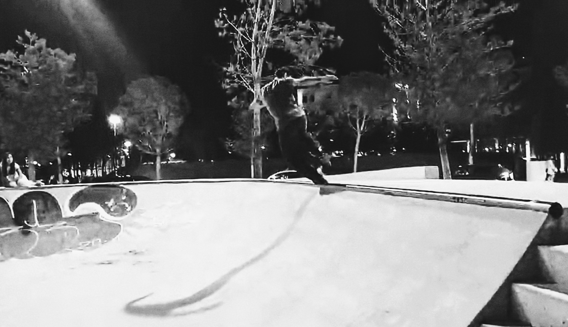
Ci siamo entrambi innamorati di questa città e ce la siamo gustata nelle nostre uscite serali per trovare qualche spot per fare skate, gustarci cibo di strada albanese e non, berci qualche birra e esplorare nuove zone.
A memoria di questa piacevole permanenza ci rimangono le meno piacevoli macchie sullo scafo causate dal carburante sversato nell'acqua del bacino portuale che ha macchiato il gelcoat vicino alla linea di galleggiamento. Rimedieremo a questo inconveniente cosmetico nel prossimo periodo in cantiere che abbiamo già cominciando a pianificare da un po': si è delineata l'idea di andare a fare cantiere a Gallipoli in Puglia una volta finito di navigare lungo la costa albanese.
La nostra meta per questo trasferimento è di raggiungere Vlöre (Valona in italiano) che dista una 60ina di miglia.
Il vento c'è e dopo un po' ha anche la direzione giusta per una confortevole navigazione.
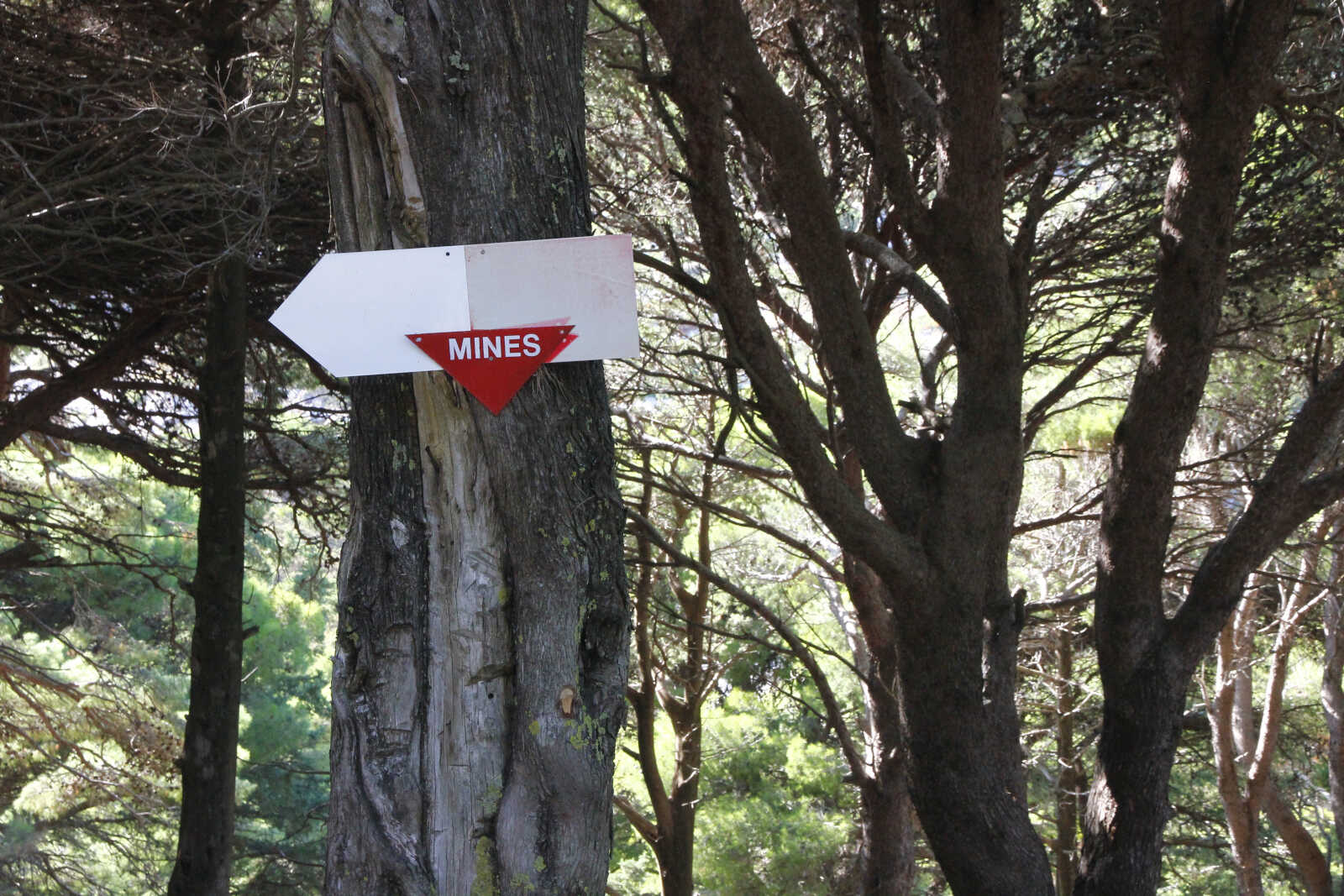
Come ogni volta abbiamo tutto il tempo che serve per esplorare con lo sguardo e il binocolo i dettagli della costa che lentamente sfila di fianco a noi. In questo tratto di costa, come in buona parte del nord dell'Albania è sconsigliato navigare troppo sottocosta: i fondali possono essere poco profondi anche molto distante dalla riva, in prossimità dei capi si estendono secche anche per diverse miglia. Non aiuta che la cartografia disponibile non sia molto accurata/aggiornata. Inoltre le innumerevoli nasse e reti da pesca sono malamente segnalate per cui si consiglia di navigare in buone condizioni di visibilità. Fino a pochi anni fa c'era anche il serio pericolo delle mine antinave, residuo del paranoico sistema difensivo voluto del regime Hoxa.
In queste condizioni tranquille ci viene voglia di calare la lenza da traina. E questa volta ci va bene: peschiamo una lampuga della grandezza giusta per due. Dopo averla squamata e pulita la mettiamo in frigo per cucinarcela la sera.
Tutto questo giusto prima del tipico rinforzo pomeridiano del vento predominante da NO che galoppiamo con buone medie coprendo molte miglia.
Nel tardo pomeriggio il vento comincia a calare e siamo in vista dell'isola di Sazan che demarca l'ingresso della baia di Vlöre. Decidiamo di aprire lo spinnaker per aumentare la nostra velocità.
Purtroppo nei preparativi per armare il tangone e le varie scotte per lo spi, Mela perde l'equilibrio cadendo sulla barra del timone e spezzandola. Per fortuna lei non si è fatta niente a parte qualche livido e l'orgoglio ferito. Non è una situazione grave e ci accorgiamo di avere tutto sotto controllo: il timone si riesce comunque a manovrare con quel che rimane della barra, ma decidiamo di calare le vele e andare a motore per ridurre lo stress sul timone per non rompere i fragili pezzi di legno rimasti. Abbiamo un timone di rispetto però la sostituzione preferisco non farla in navigazione. Decidiamo di trovare un ancoraggio di fortuna e passare la notte, che per fortuna è prevista tranquilla, in rada.
Cerchiamo con scarso successo di nasconderci dallo swell del mare aperto dietro al prolungamento della foce del fiume Vojussa.
Ancoriamo in circa 5m di sabbia: la spiaggia è comunque lontanissima. Mi metto subito al lavoro per sostituire la barra del timone. Finisco che il sole è tramontato: ormai le giornate si stanno accorciando a vista d'occhio.
Ci consoliamo con il nostro pesce e andiamo a letto presto.
Il mattino dopo partiamo alle 0730 per coprire le 15 miglia che ci separano dalla nostra meta, appena la nebbia, altro indizio che siamo ormai a fine estate, comincia a diradarsi.
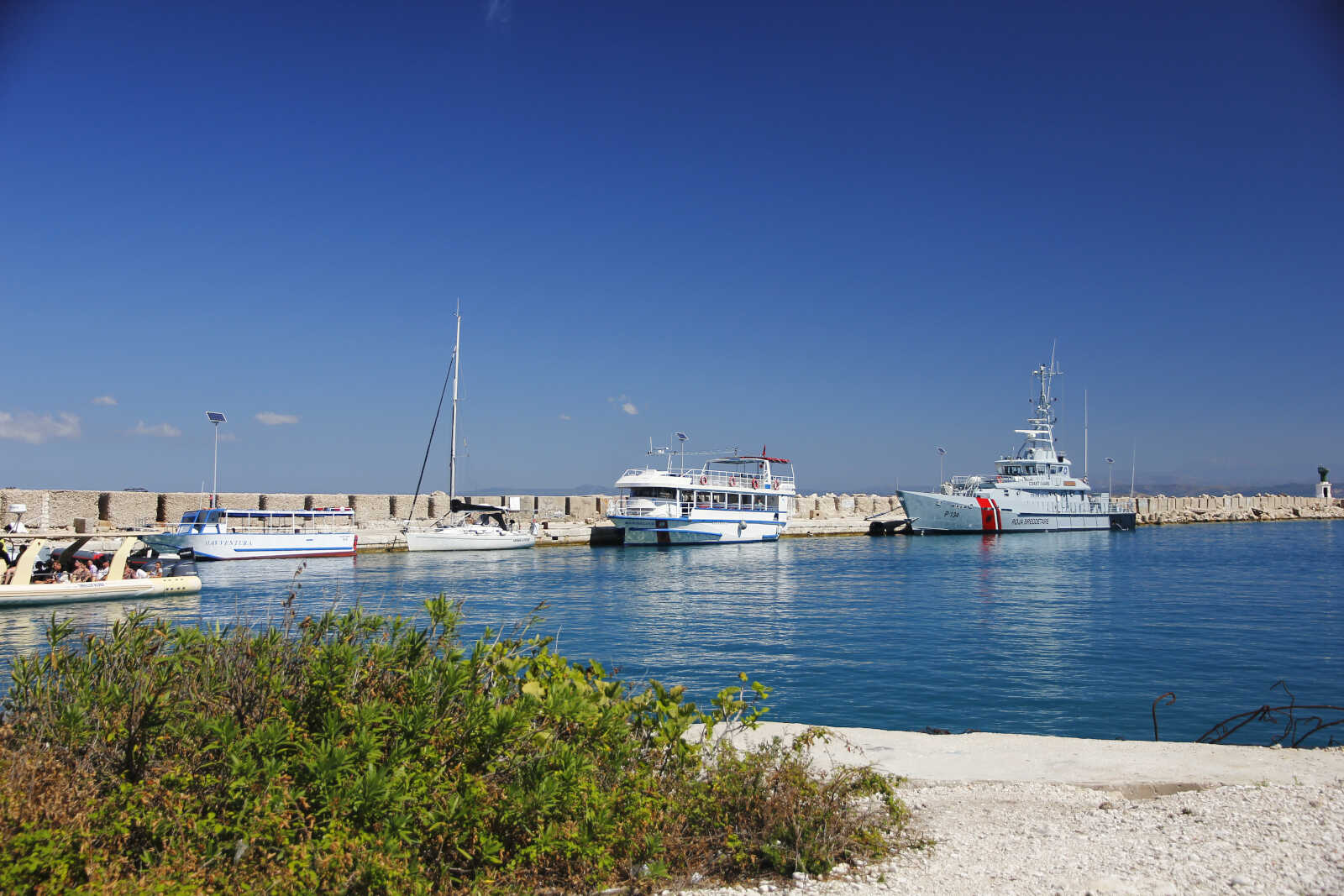
Arriviamo a Valona con una 20ina di nodi di poppa ma troviamo un buon ancoraggio protetto dal molo del porto commerciale. Ci fermiamo per un paio di giorni per fare rifornimenti e vedere parti della città che non avevamo visto la settimana precedente. Trovo persino un piccolo skate park: l'unico che ho visto in tutta l'estate. Ne approffitto per qualche trick che attira l'attenzione di alcuni ragazzini che iniziano a conversare un po' con noi.
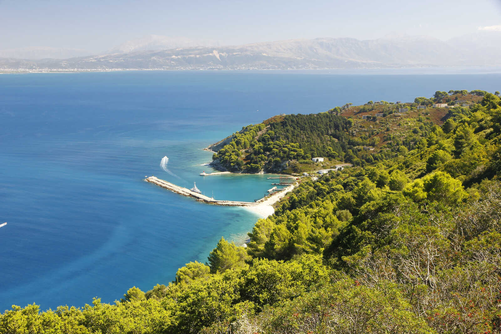
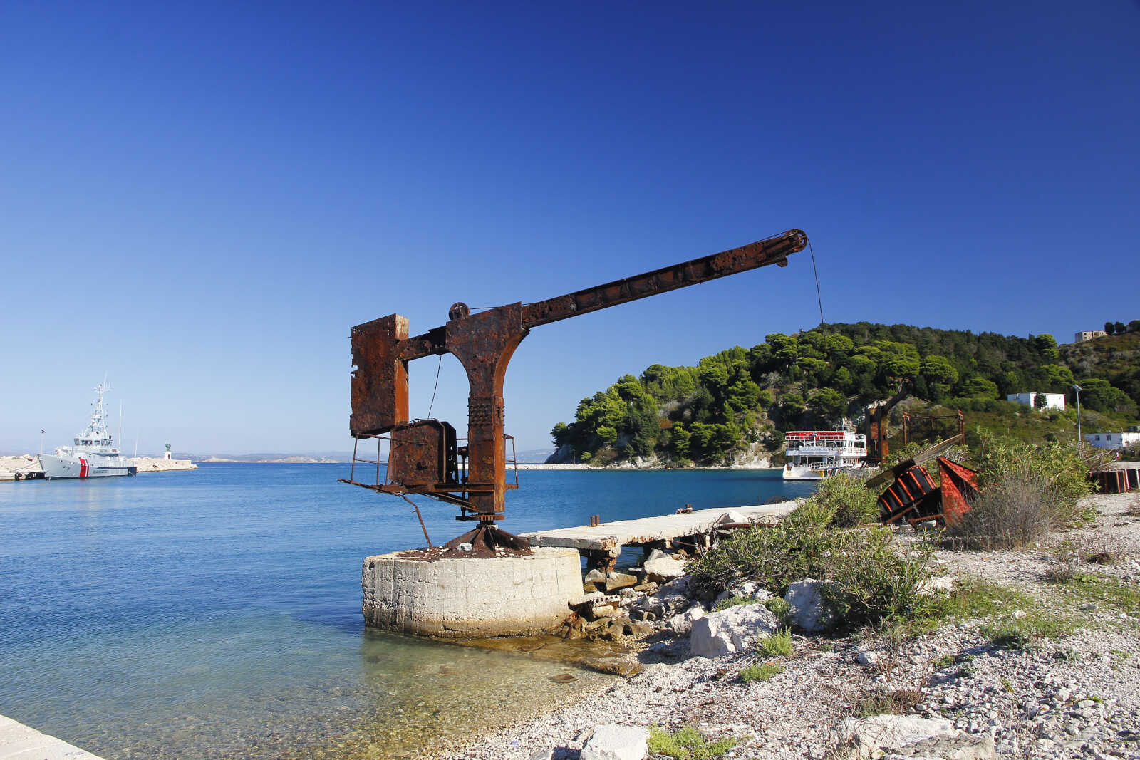
Il 19 decidiamo di andare a visitare l'isola di Sazan che è a circa 9 miglia di distanza: l'unico approdo è il porto militare situato nell'unica baia dell'isola, dove, previo permesso, si può attraccare nelle ore diurne. Siamo l'unica barca a vela e tutti i conducenti dei barconi e gommoni che aspettano i turisti da riportare indietro a Valona, vogliono aiutarci con le manovre di ormeggio e sono curiosi di conoscerci e interagire.
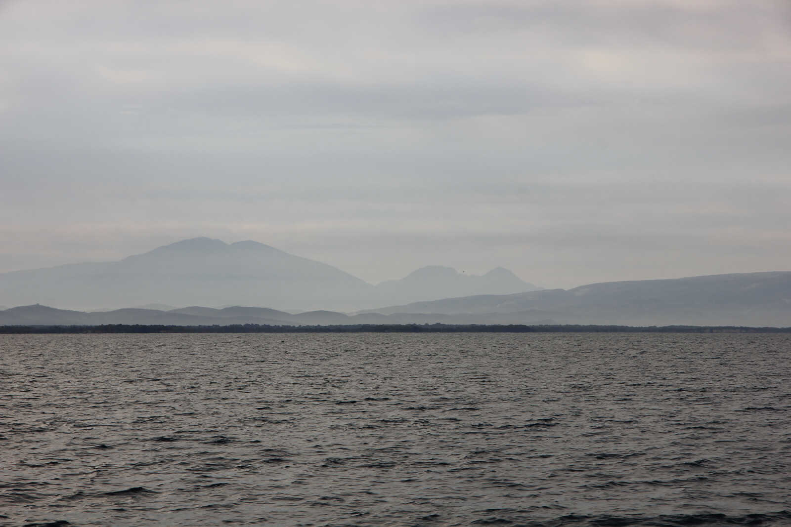
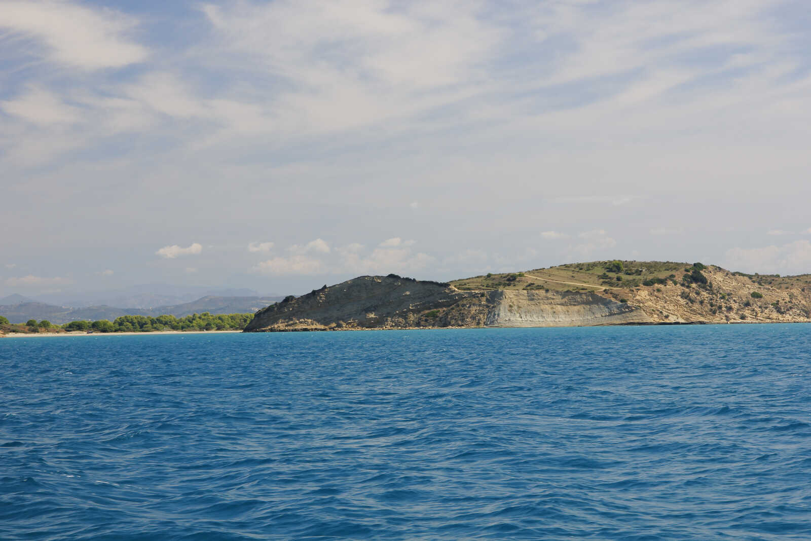
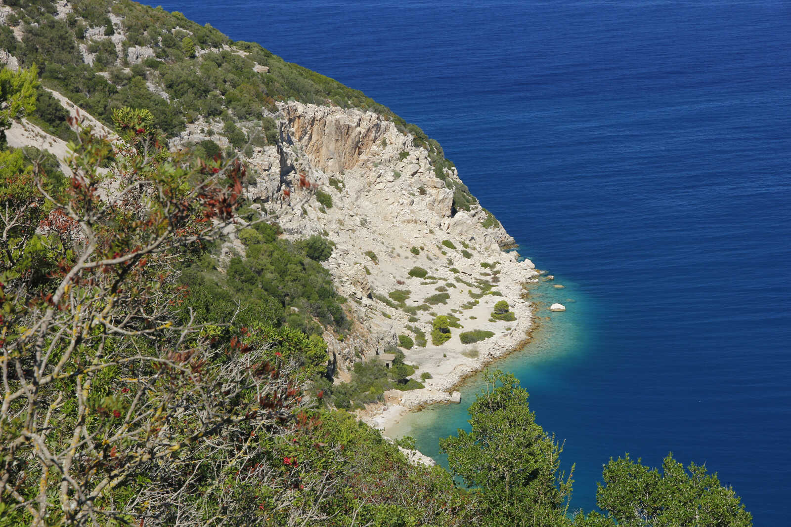
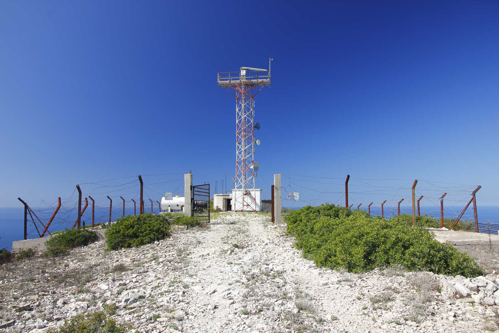
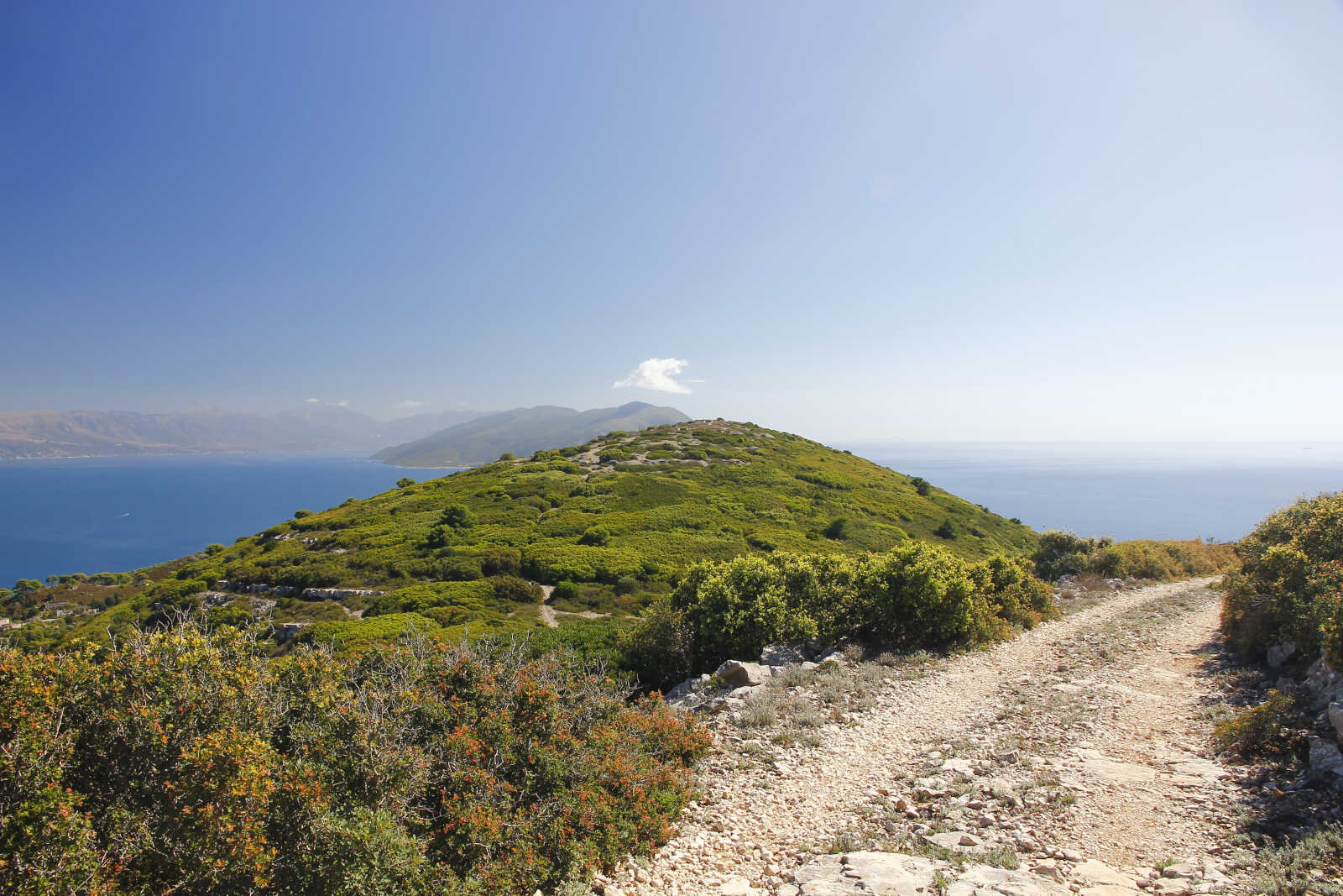
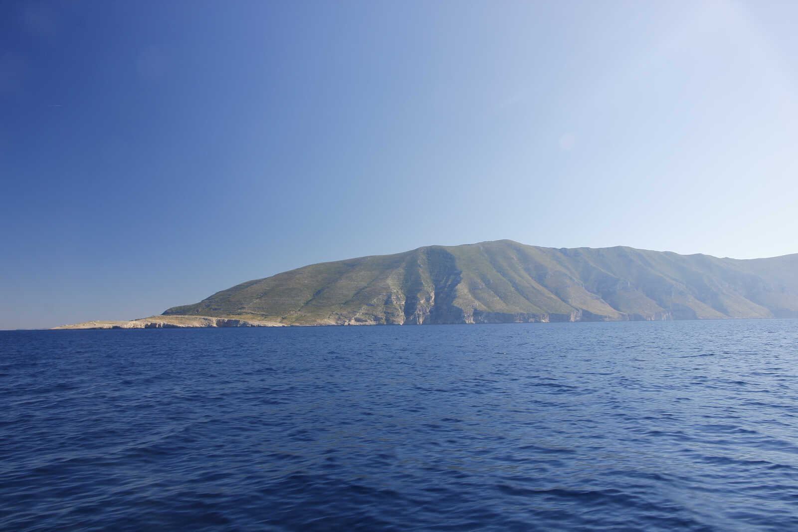
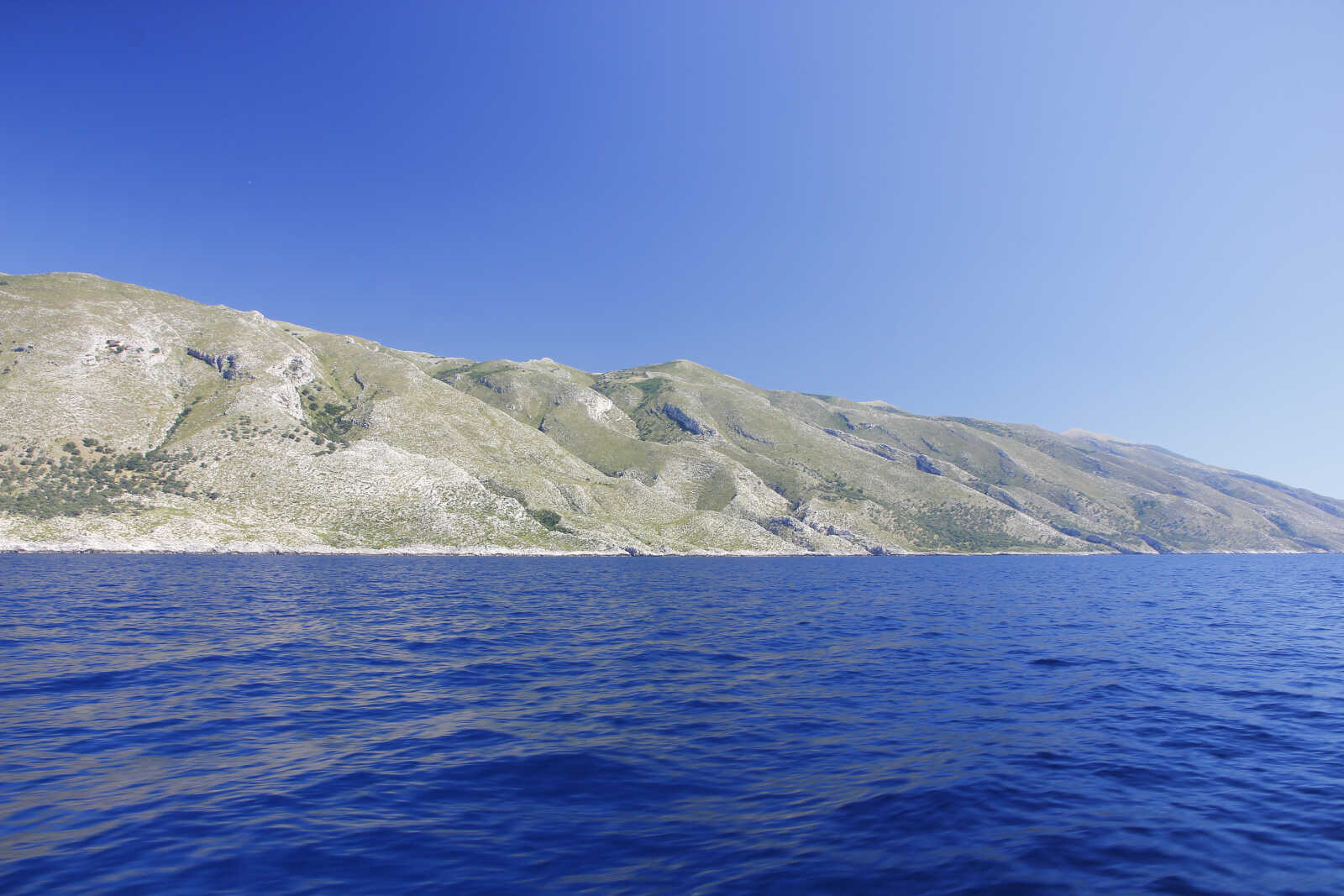
L'isola, la più grande dell'Albania, si staglia alta sul mare e offre una bella camminata fino alla cima di 337m da cui si gode una grandiosa vista sulla costa albanese, i vari capi, foci, la laguna con le sue saline appena dietro Valona, la penisola di Karaburun che chiude la baia di Valona con la catena montuosa degli Acrocerauni che muore sul mare e segna un cambio netto nella morfologia costiera: da qui in poi cominciano le coste alte e rocciose, le falesie, i canyon scavati dai torrenti che finiscono nel mare cristallino creando piccole calette. Inizia la parte ionica dell'Albania.
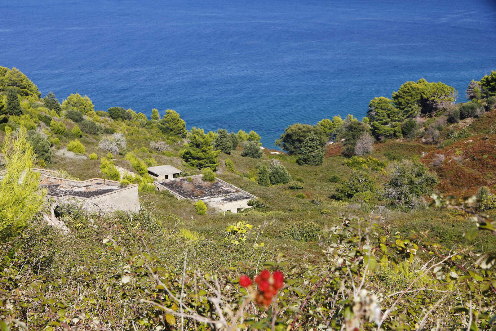
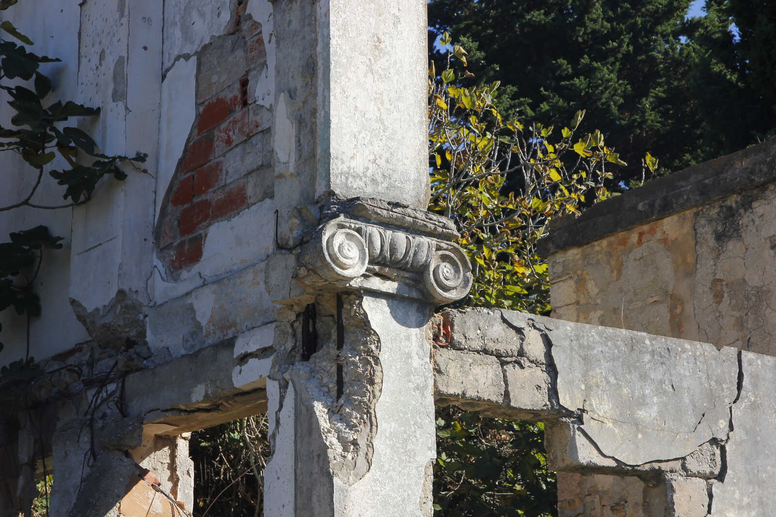
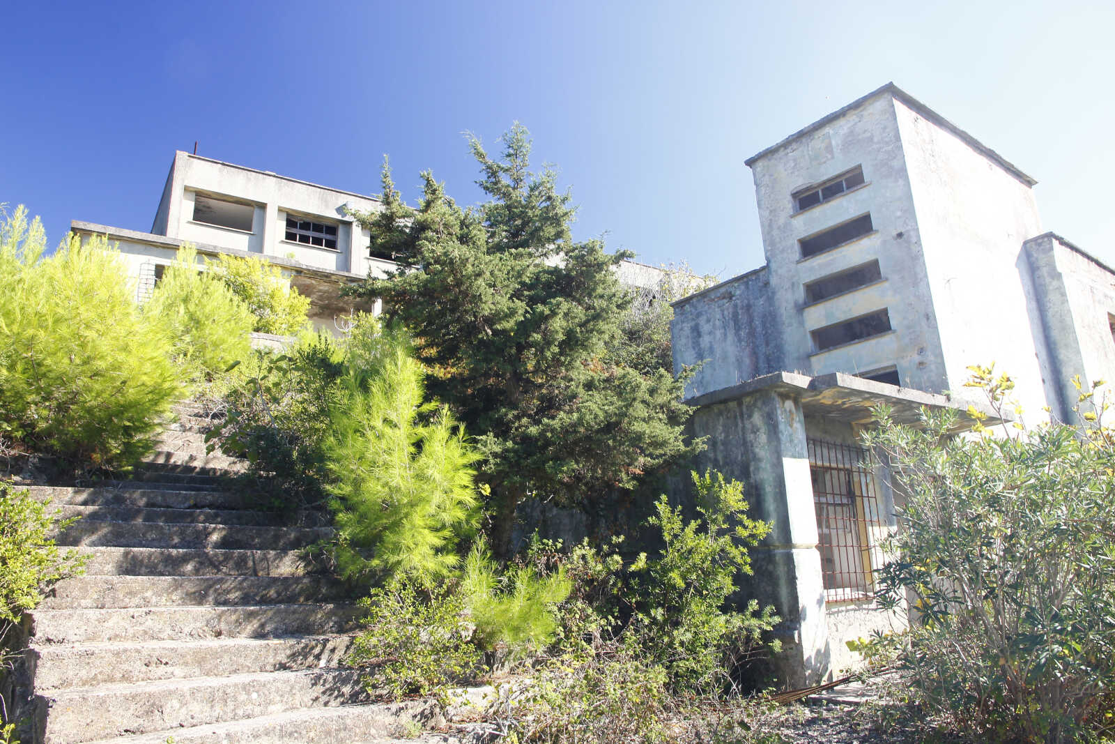
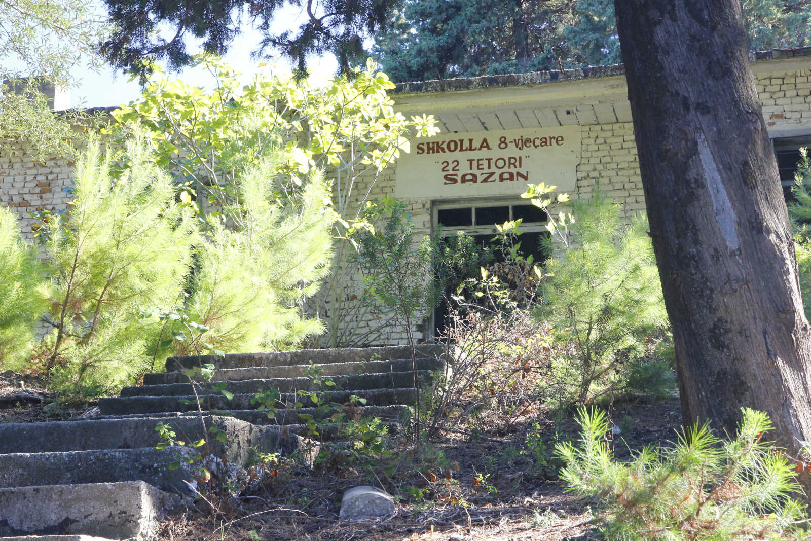
Oltre ai colori della vegetazione mediterranea si possono ancora vedere sparsi per l'isola i resti della città fantasma che ospitava i militari e le loro famiglie durante il periodo della guerra fredda. Al suo picco ci vivevano 10.000 persone, con tanto di cinema e scuole. Poi al cadere del regime comunista l'insediamento andò presto in rovina, essendo Sazan completamente dipendente dai rifornimenti, persino per l'acqua.
Ci sono tracce anche del precedente insediamento militare italiano di epoca fascista, quando quest'isola era territorio italiano.
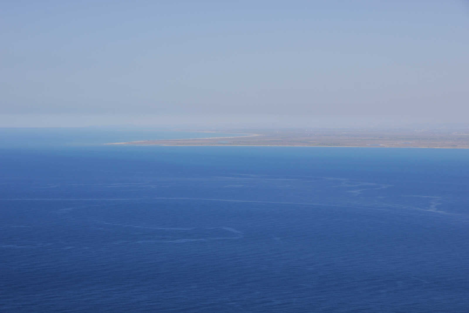
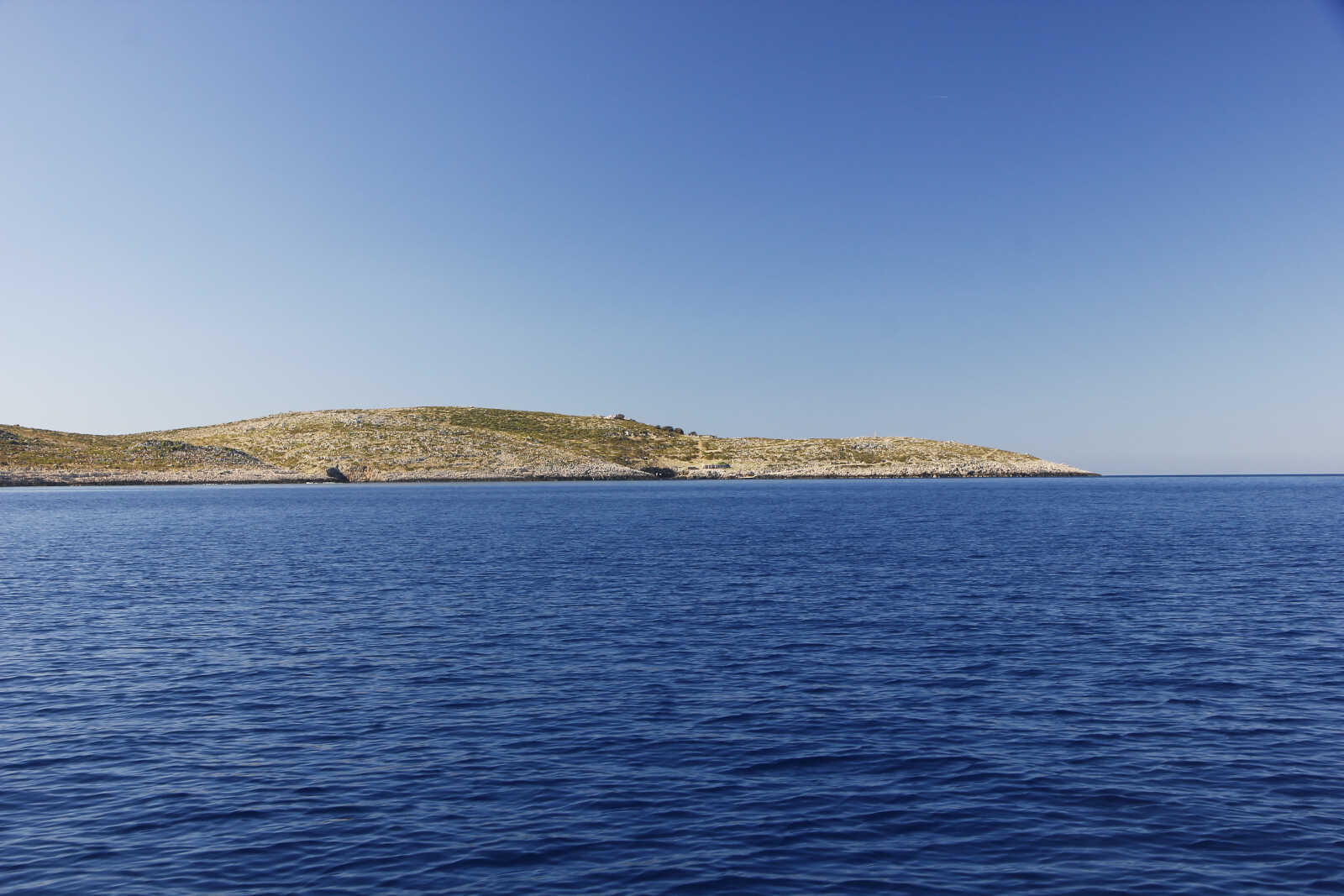
Vista verso Nord con le basse coste sabbiose e la foce del fiume Vajoussa che protrude.
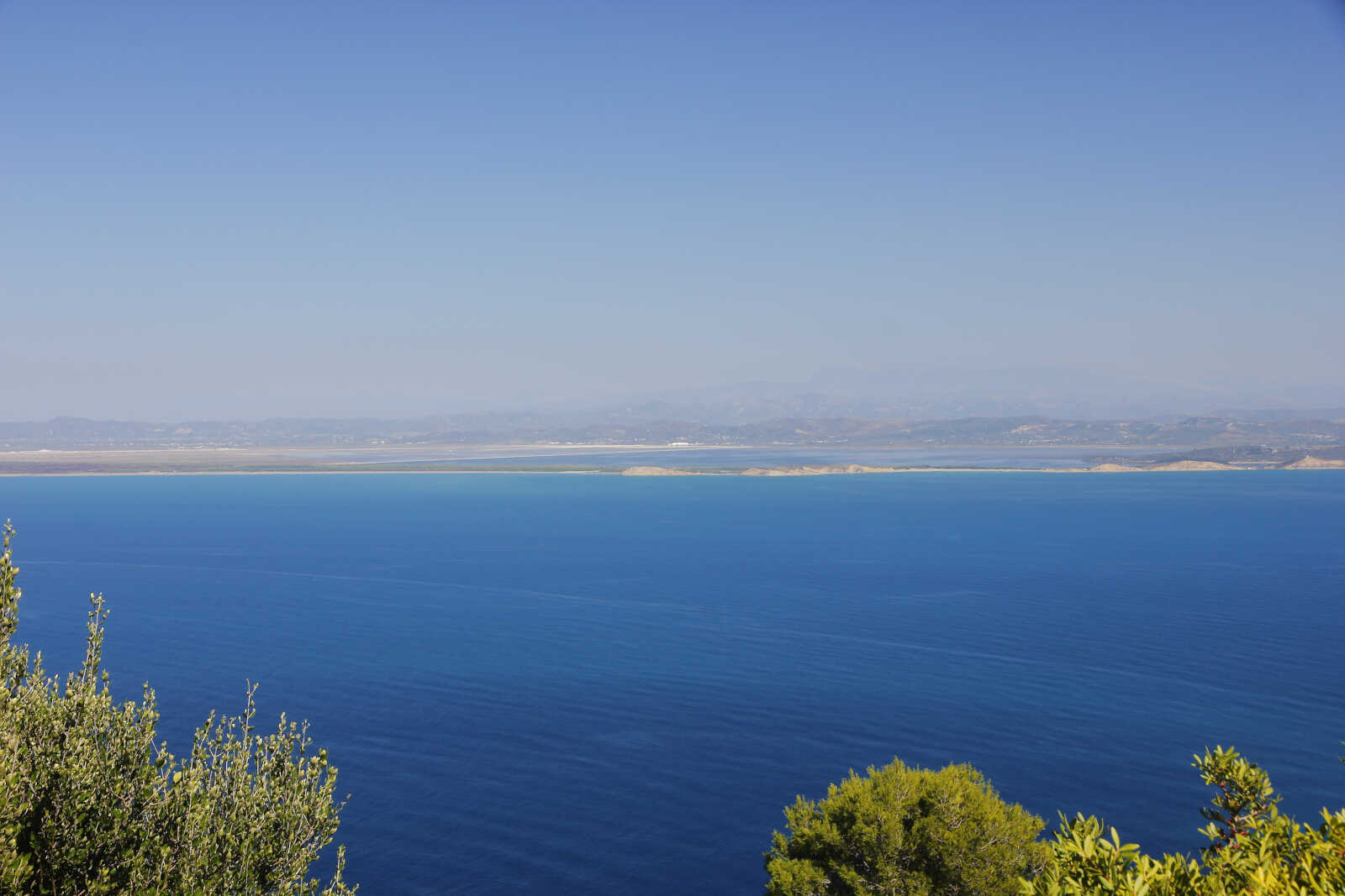
Vista della laguna che si trova appena dietro Valona con le sue saline, separata da una sottile striscia di terra dal mare aperto.
Finita l'escursione torniamo a Valona sotto spinnaker e riancoriamo nel solito posto per la notte.
Il 21 andiamo invece ad ancorarci in una bella baia sul lato nord della punta della penisola di Karaburun. Tutta la penisola fa parte di un parco nazionale di recente istituzione. L'idea è di passare qui la giornata per poi essere pronti l'indomani a lasciare la baia di Valona e iniziare a navigare verso sud. Abbiamo cercato di aspettare le condizioni favorevoli per poter ancorare in una delle piccole calette caratteristiche di questa costa, ma è in arrivo una perturbazione con vento da sud che durerà diversi giorni e non possiamo aspettare oltre per essere sicuri di raggiungere un ancoraggio ridossato più a sud.
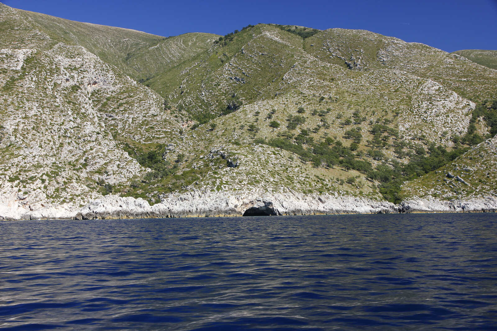
Per cui ci rassegniamo a vedere questo tratto solo in navigazione. Ma che spettacolo! Le foto rendono solo in minima parte la bellezza che noi abbiamo potuto ammirare per ore. Qui l'acqua è profonda e riusciamo a navigare vicini alla costa e assorbire i dettagli della sua morfologia.
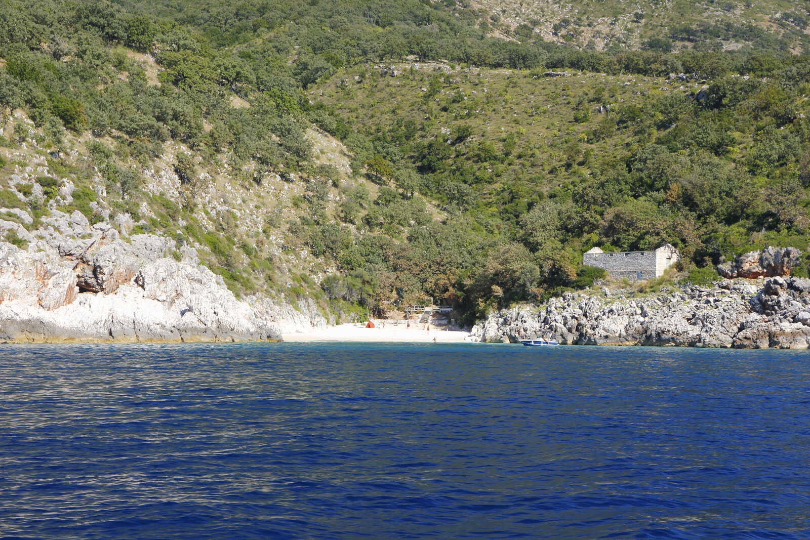
Appena passato il Parco Nazionale, l'ennesimo villaggio turistico in costruzione vicino Dhermi
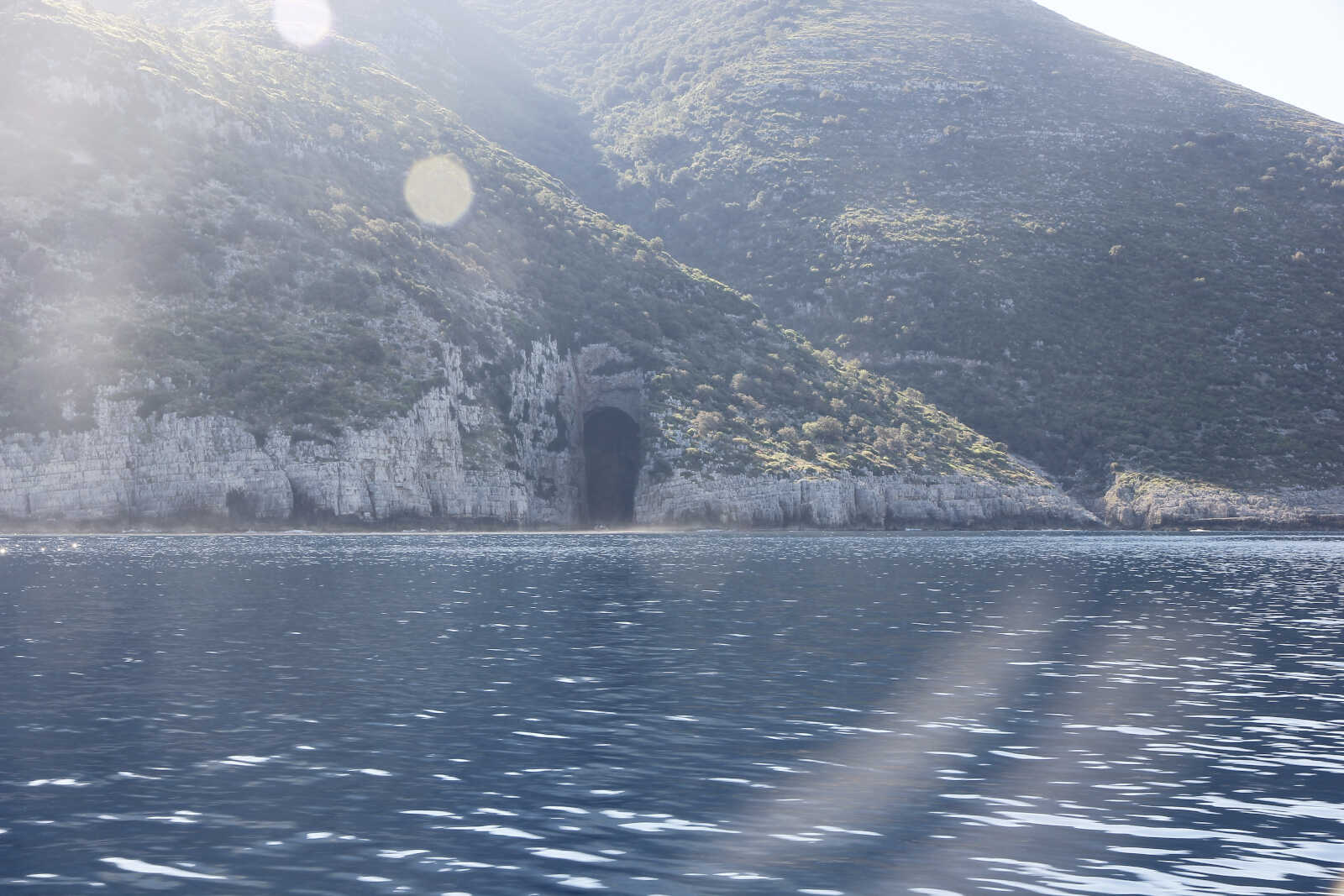
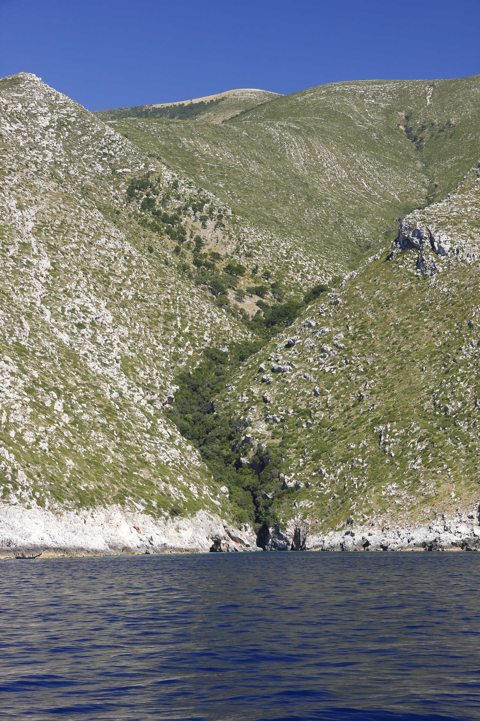
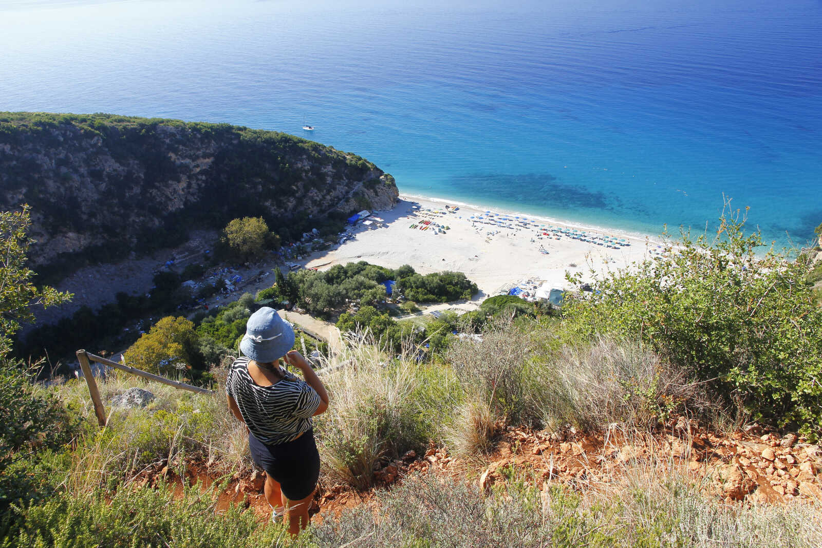
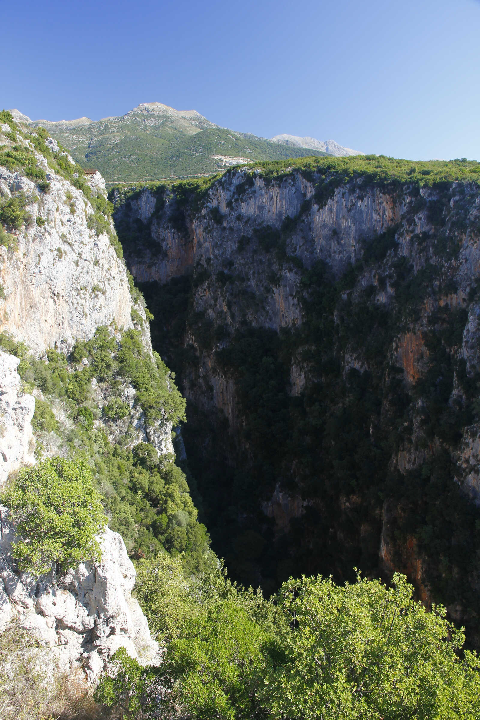
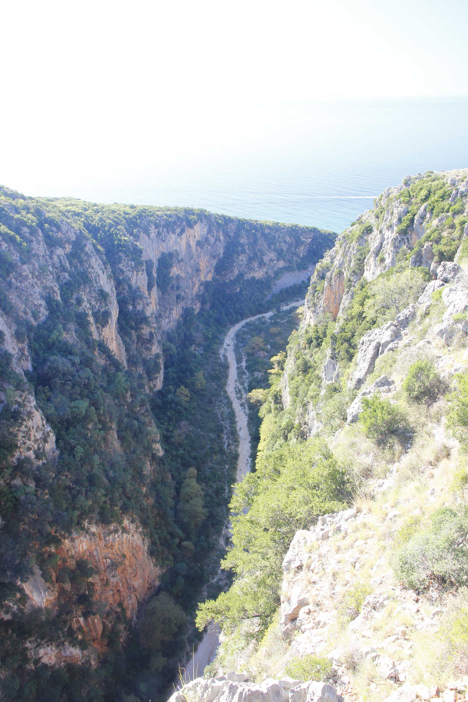
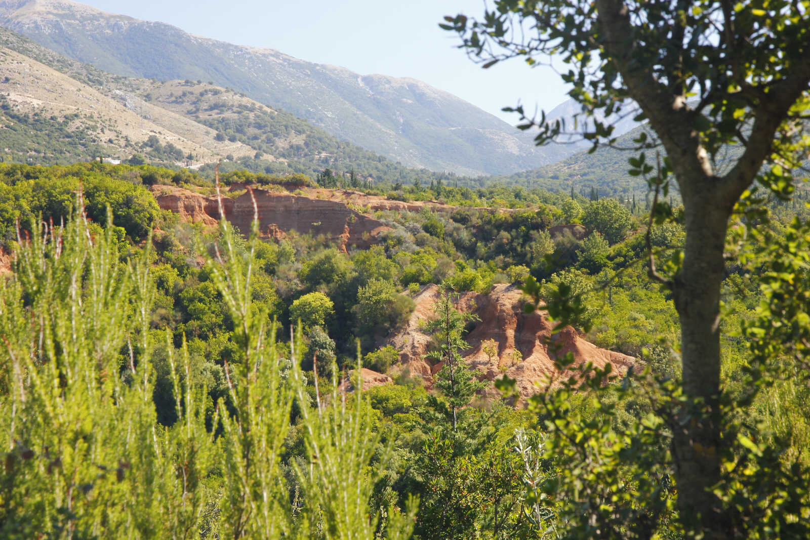
Dopo 30 miglia raggiungiamo la nostra meta: facciamo tappa a Giri Gjipes per la notte, ancorati di fronte allo sbocco sul mare di un profondissimo canyon. L'ancoraggio è discretamente protetto e passiamo una notte tranquilla. Il giorno dopo andiamo a fare una passeggiata lungo il ciglio del canyon. Che panorami e che colori…
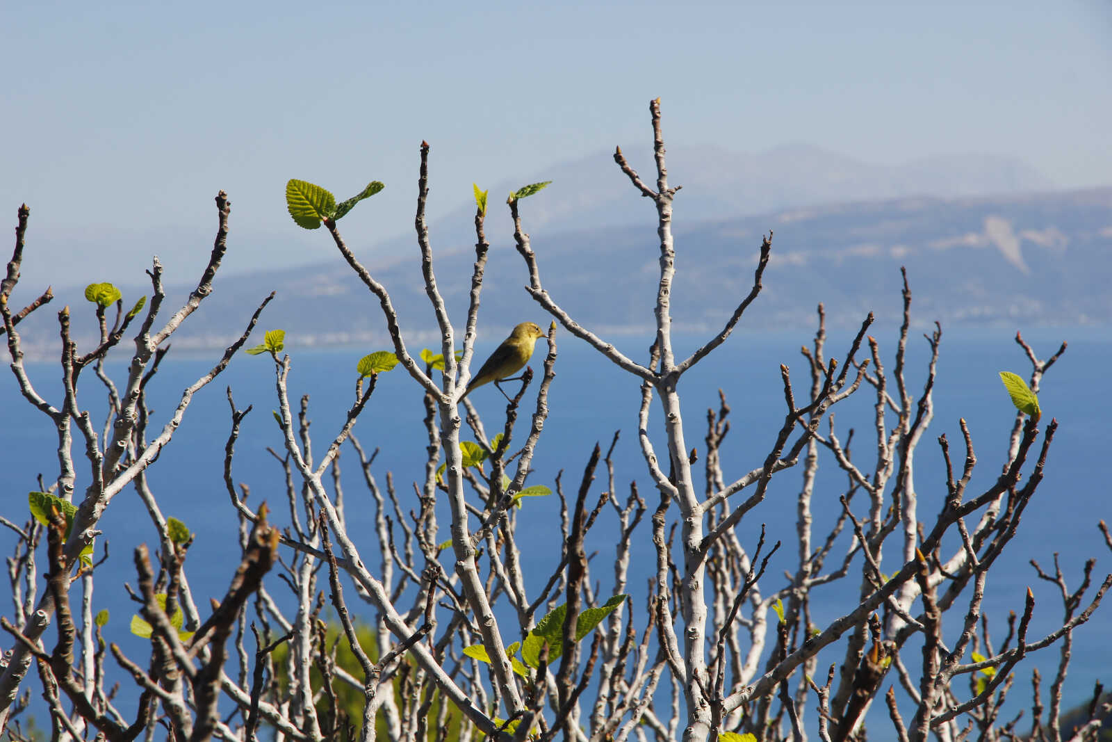
Facciamo anche scorta del profumatissimo timo e salvia che cresce abbondante dappertutto.
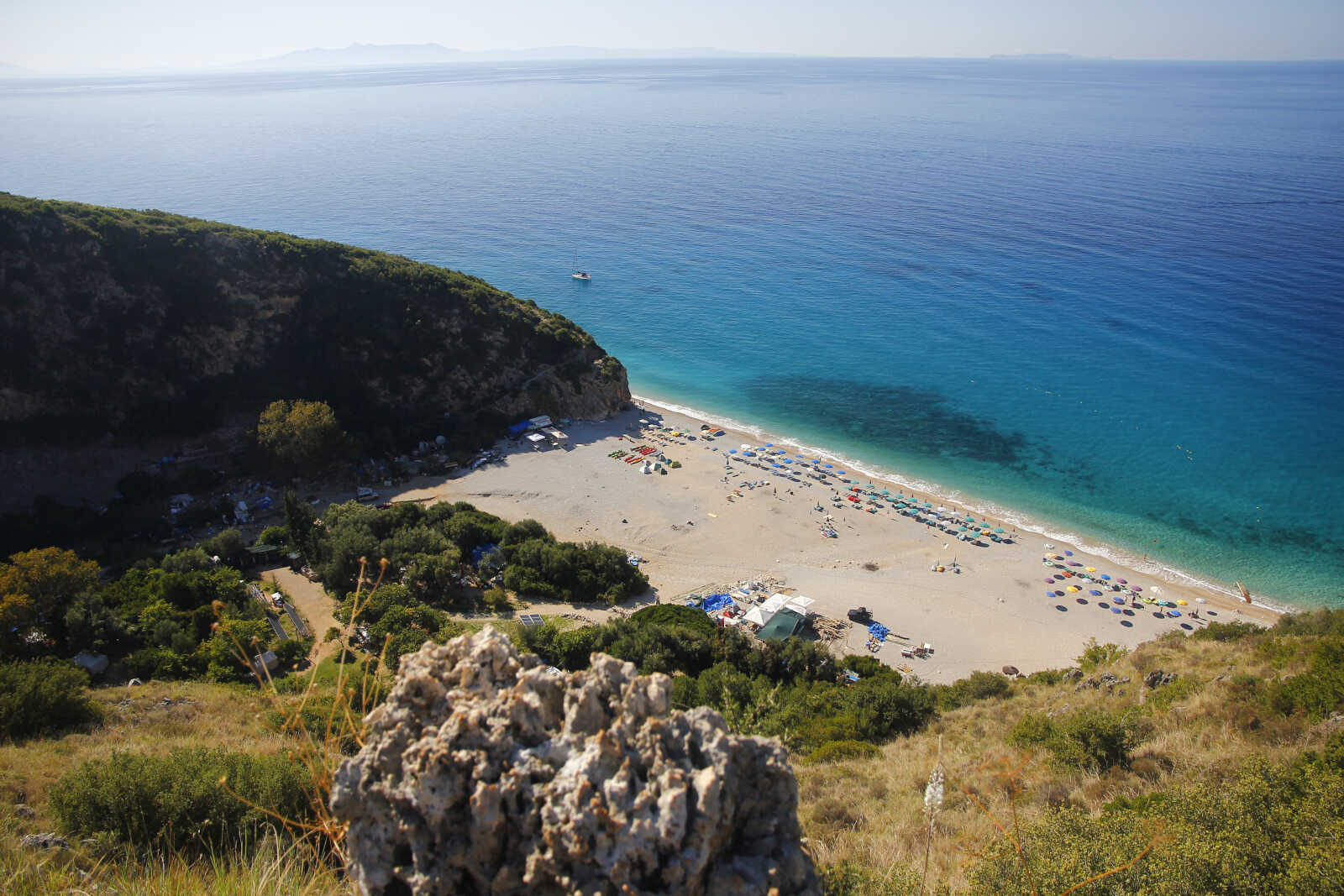
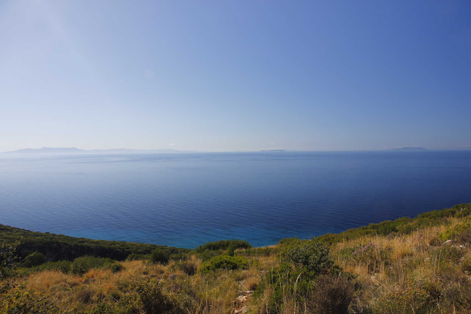
Da qui si vedono (da sinistra) Corfù, Othonoi e Erikousa; le più settentrionali isole greche.
Tornati a bordo dopo la passeggiata decidiamo di levare l'ancora e proseguire visto che l'ancoraggio è diventato molto scomodo per via delle onde e proviamo a dirigerci verso porto Palermo che dista solo 7 miglia.
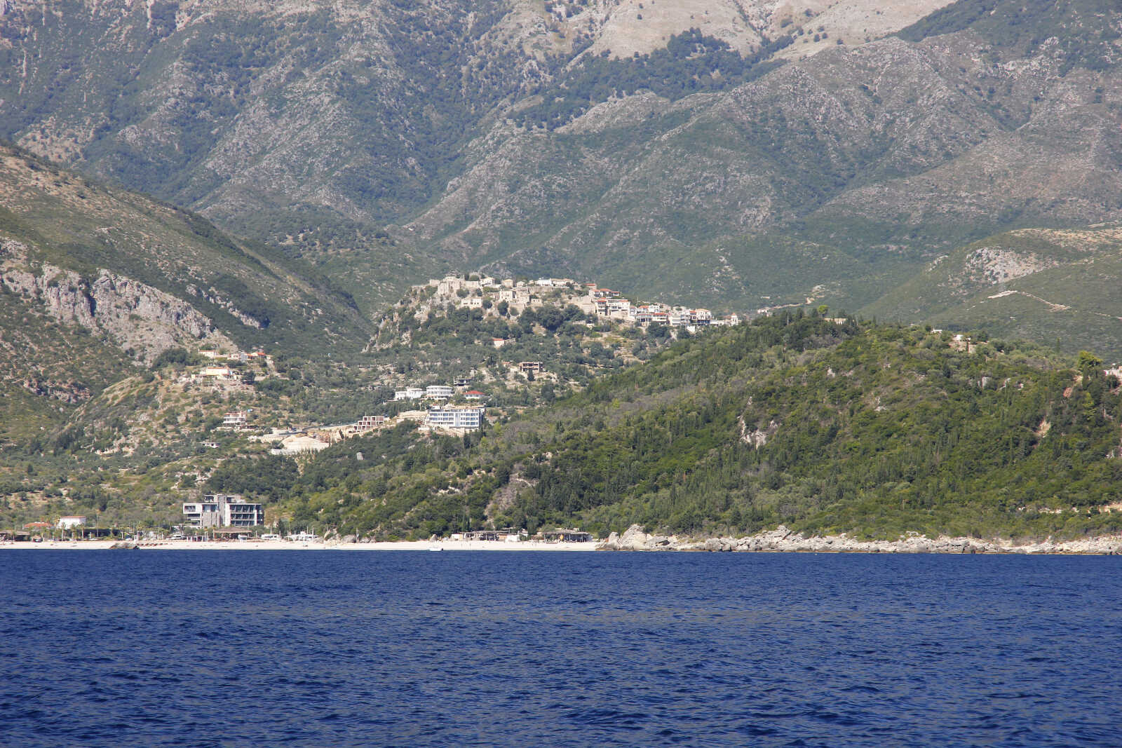
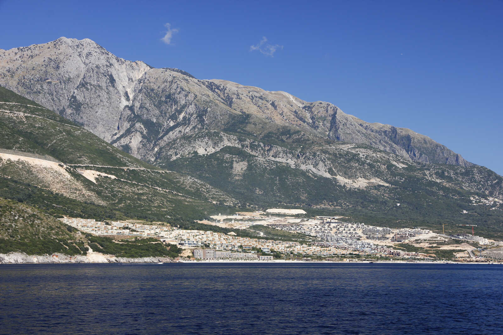
La città vecchia di Himare arroccata sopra la nuovissima località balneare
Siamo un po' restii ad andare a Porto Palermo perché, nonostante sia l'unico porto naturale (usato fin dall'antichità), stando ai resoconti che abbiamo letto l'ancoraggio non è così sicuro come tenuta ed è flagellato da potentissimi venti catabatici notturni. Anche la coppia di tedeschi che avevamo incontrato a Durazzo ci avevano spaventato con storie di ancore spedate nel mezzo della notte con venti a 50 nodi.
Decidiamo per lo meno di entrare nella baia per farci un'idea. Ci dovrebbe essere anche un molo usato dai pescatori ma abbiamo letto che è sempre occupato e alcuni croceristi sono stati cacciati in malo modo.
Contro ogni aspettativa troviamo invece il molo completamente libero e anzi: della gente del posto ci assicura che c'è posto per noi e che possiamo rimanere la notte.
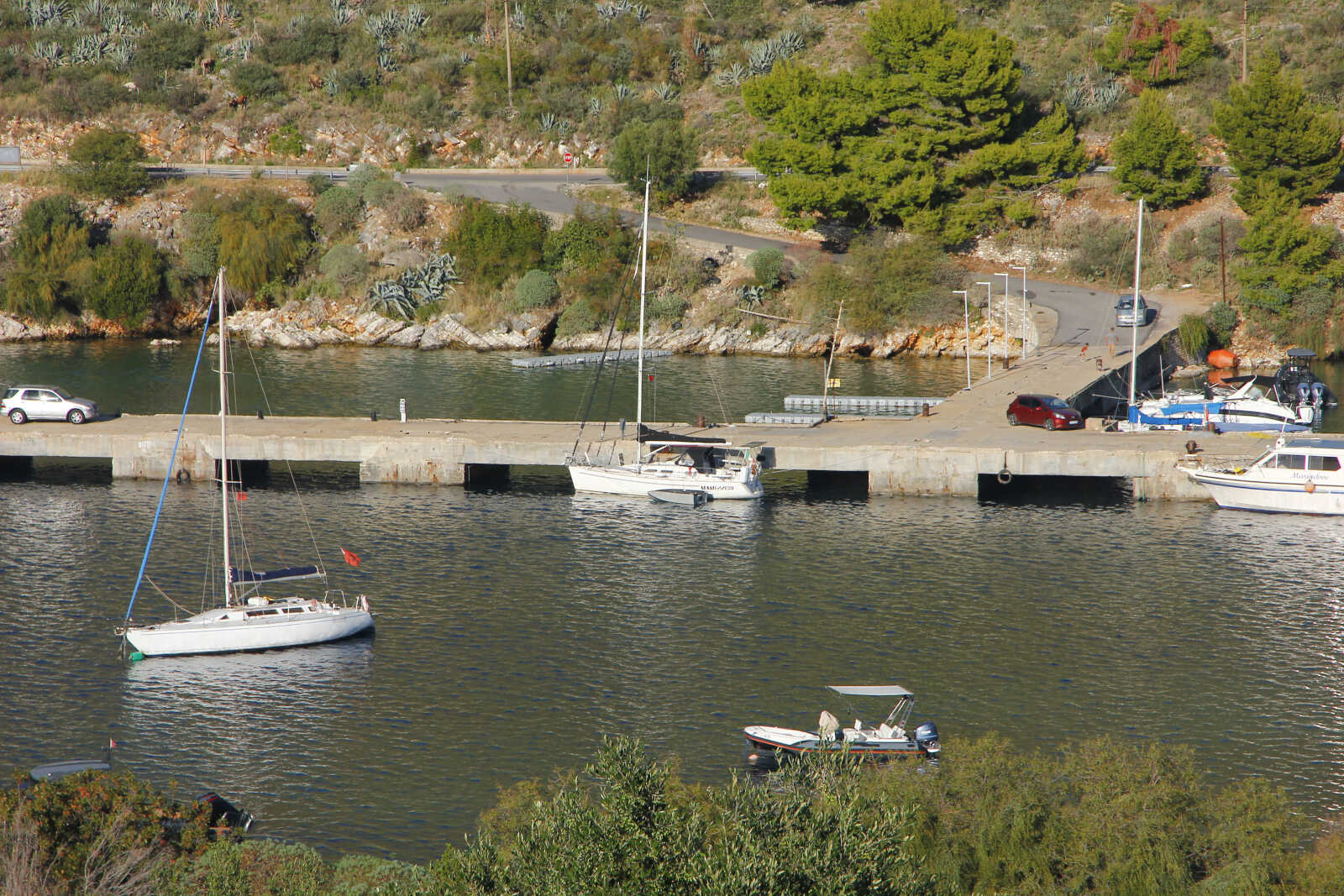
Siamo l'unica barca straniera in tutto il porticciolo.
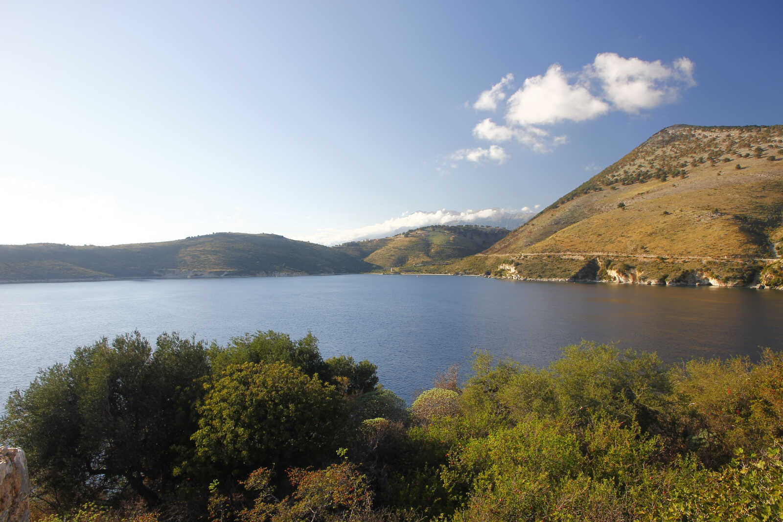
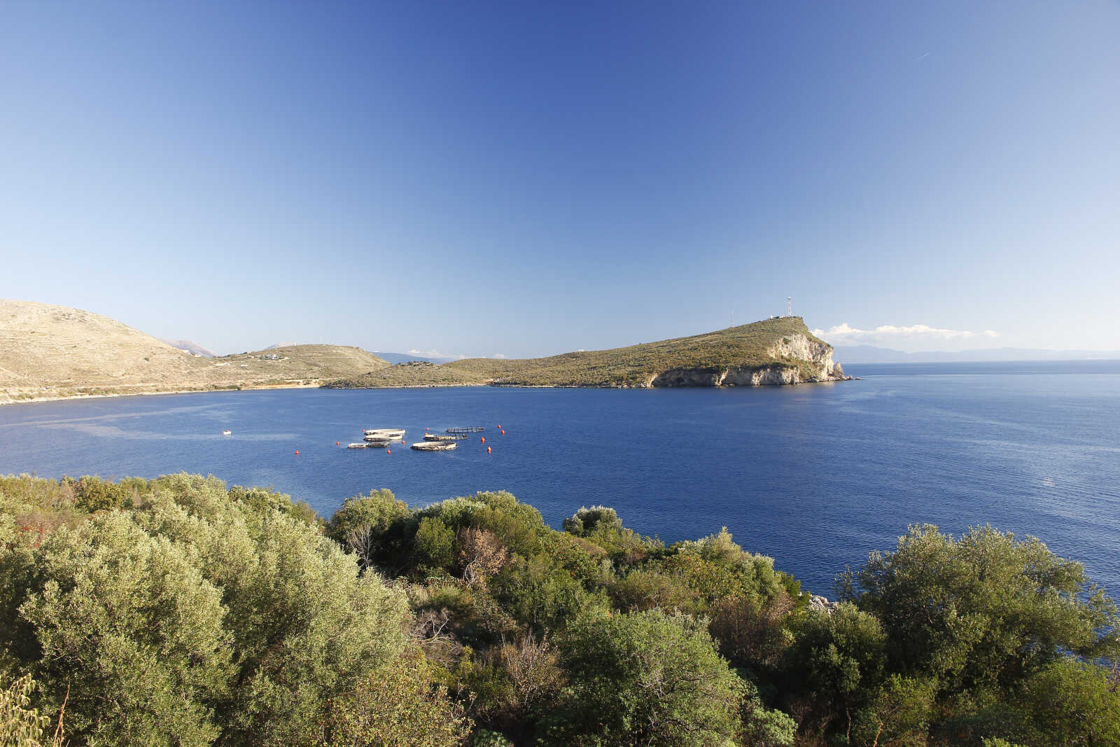
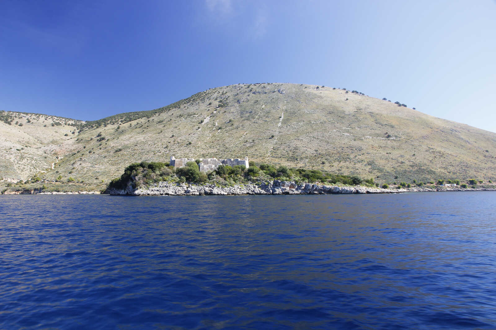
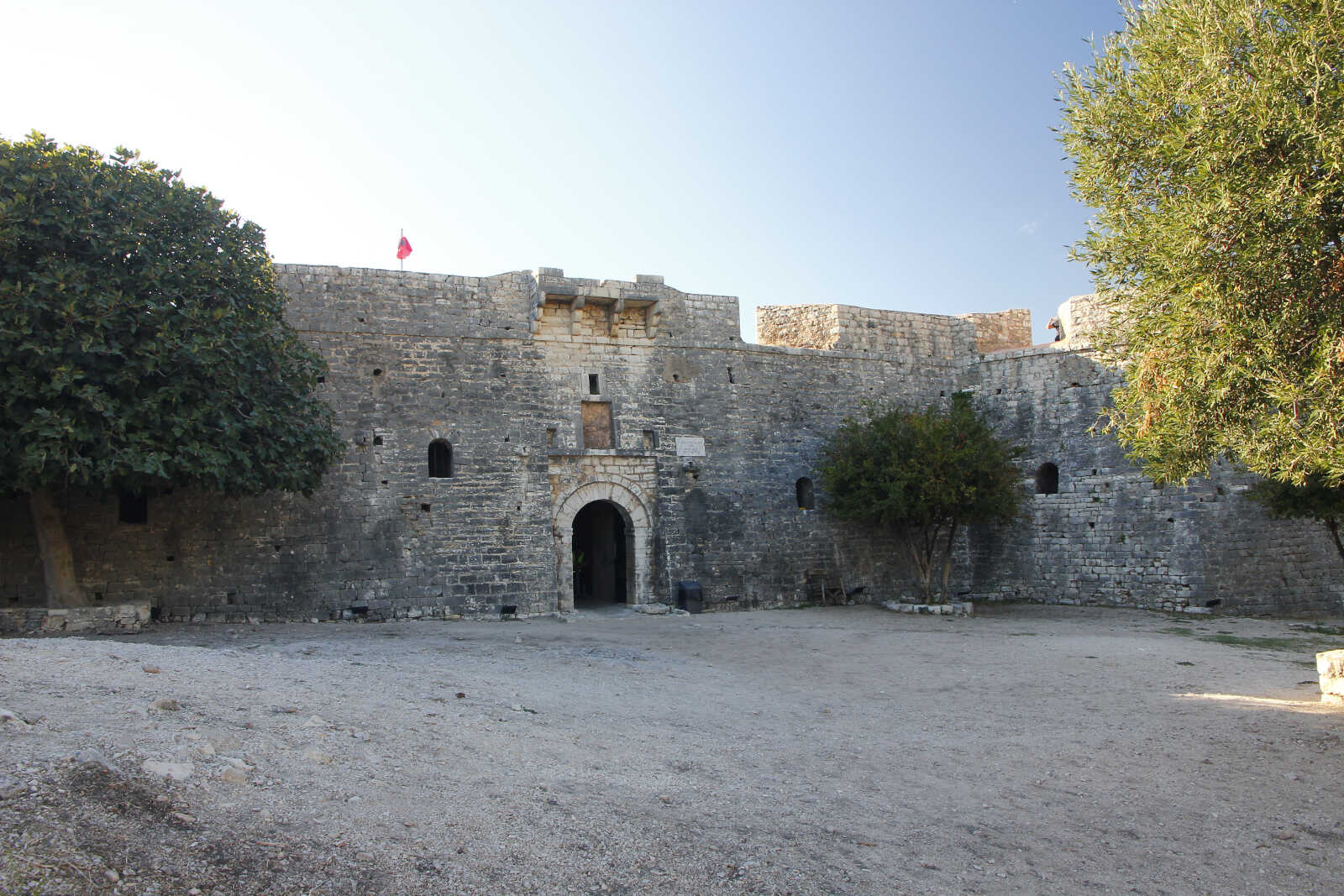
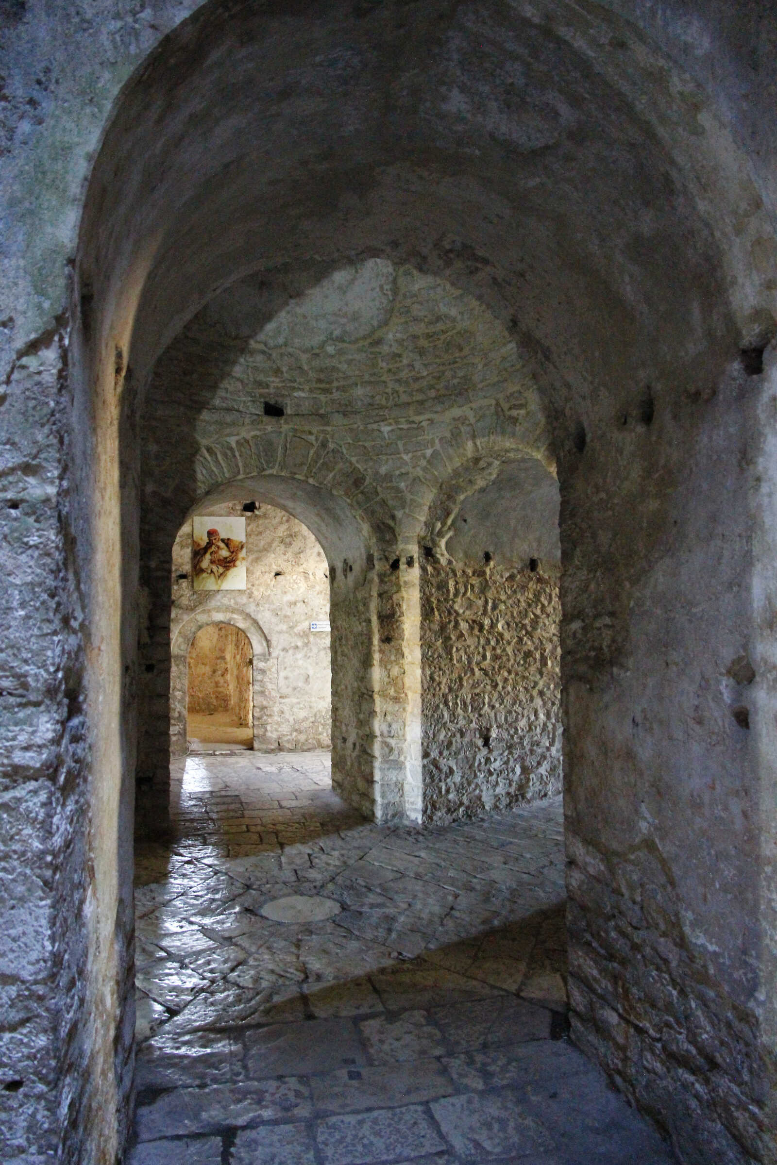
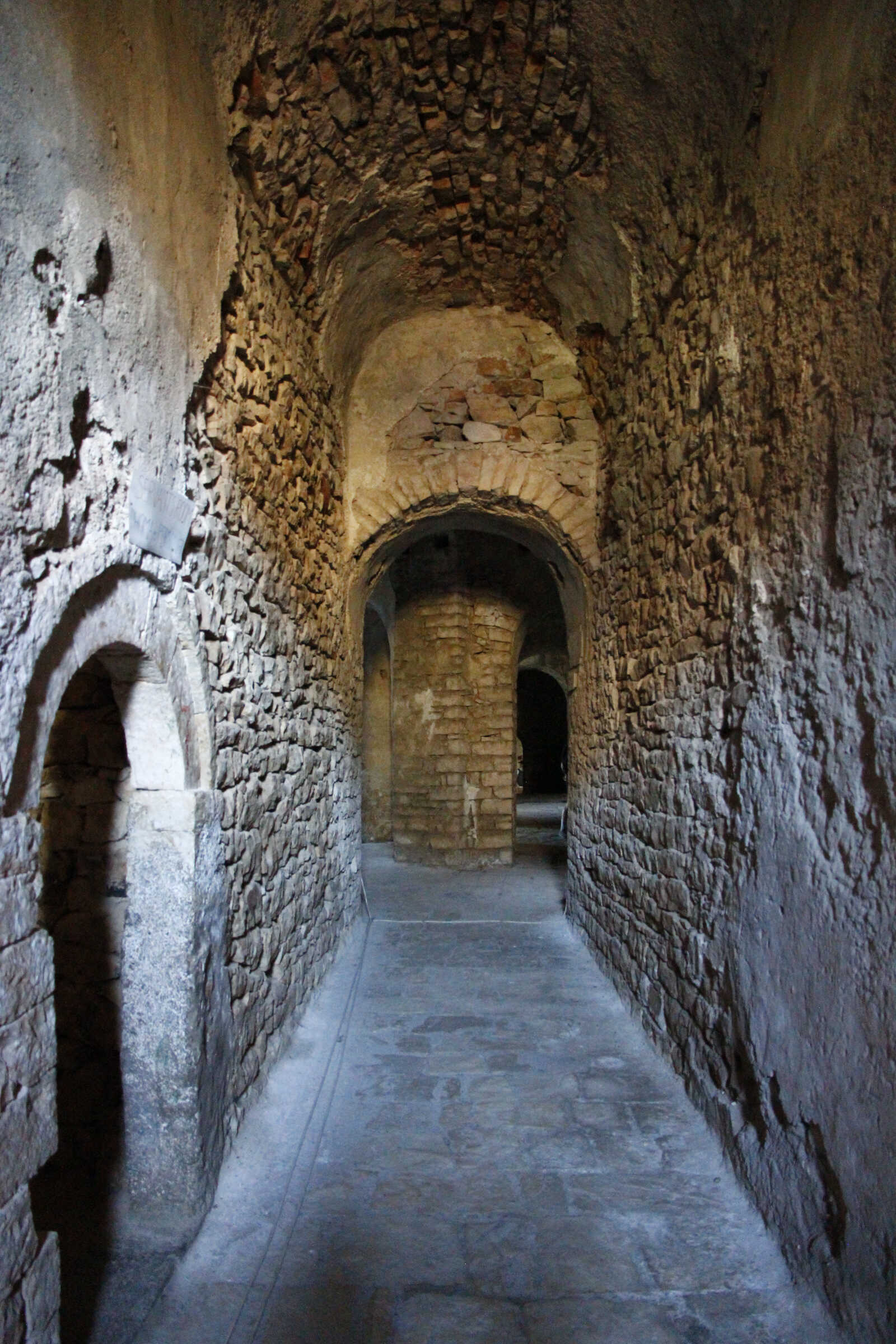
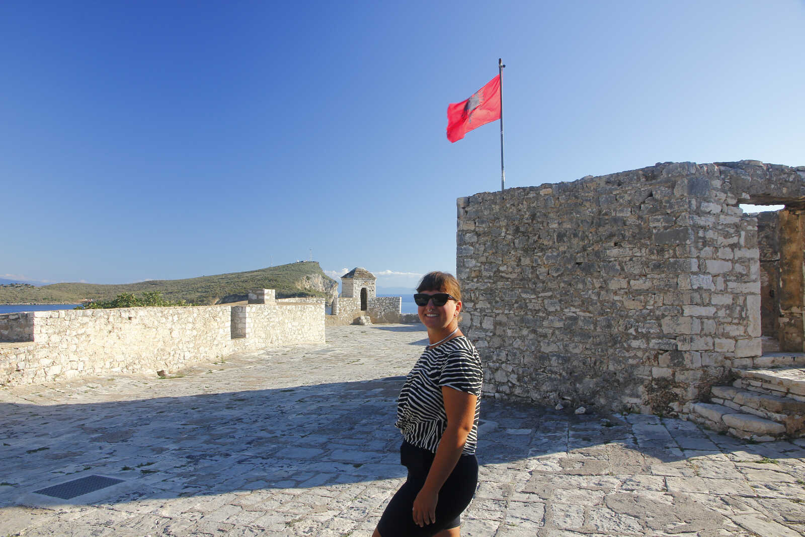
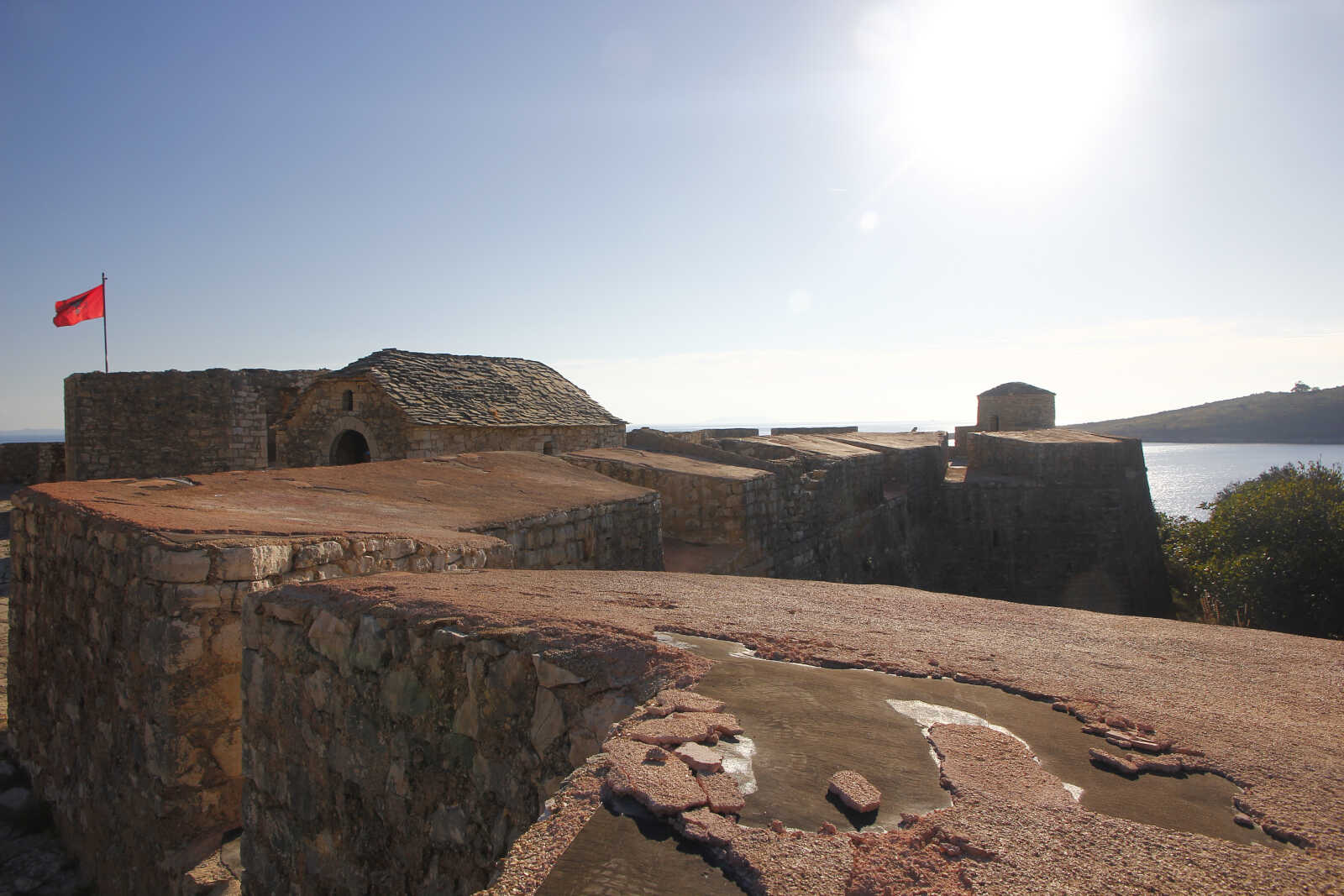
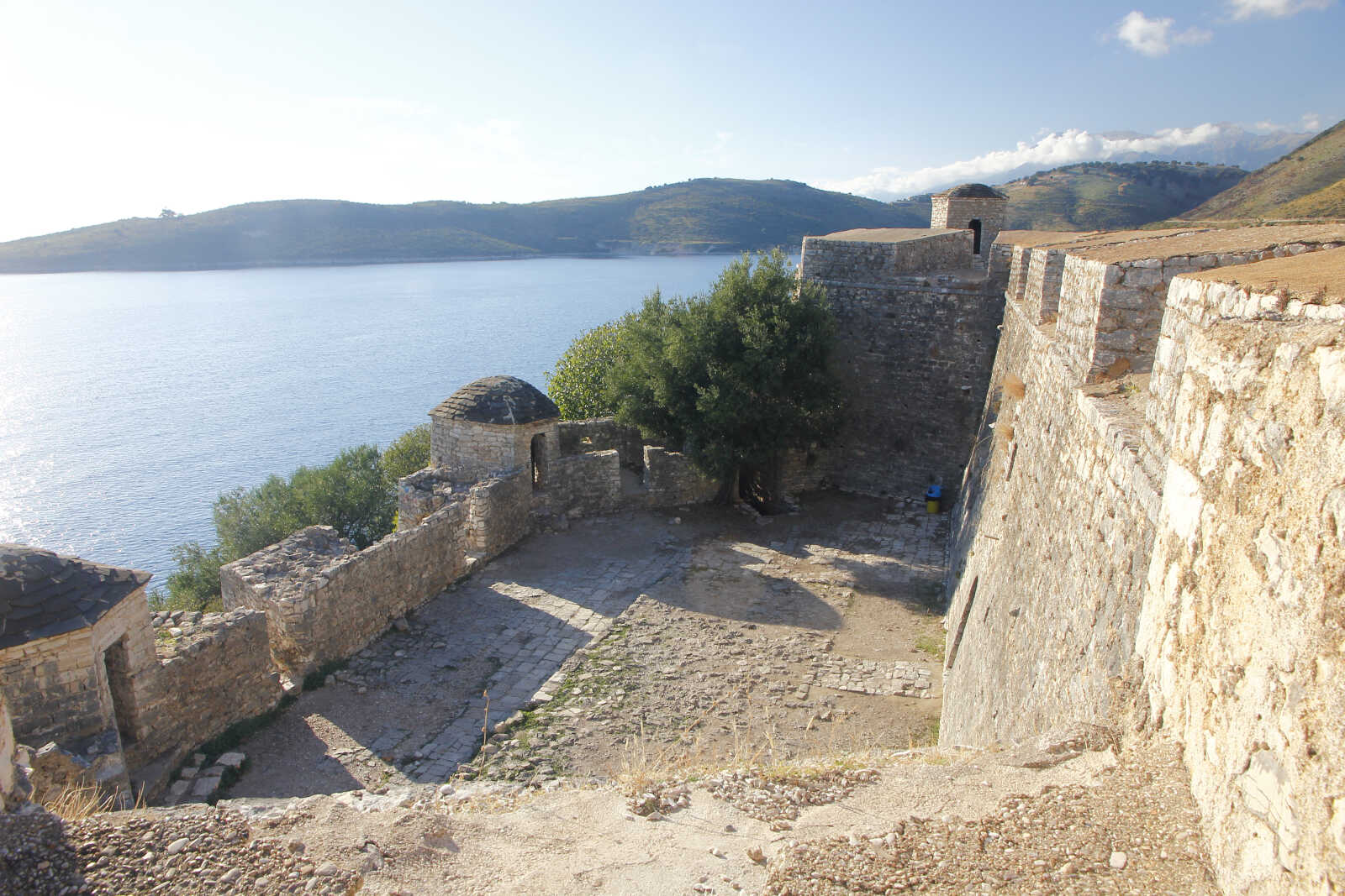
Finalmente possiamo assaporare il brullo ma mesmerizzante paesaggio del catino di monti che abbraccia la baia di Palermos. La vasta baia è divisa in due da un'isola collegata a terra da un istmo, su cui sorge la fortificazione a base triangolare con un bastione per ogni vertice. Attribuita ad Ali Pasha di Ioannina, ne visitiamo gli oscuri interni dalle alte volte che si incrociano in complicate suddivisioni geometriche. Fin che non si emerge nel luminoso cortile sul tetto che offre una vista a 360 gradi.
Il nostro Ali fu una carismatica figura cresciuta nei ranghi dell'apparato burocratico ottomano fino a guidare una ribellione che portò sotto il suo controllo buona parte dell'Albania e della Grecia settentrionale fino alla sua cattura e esecuzione nel 1822 a 82 anni!
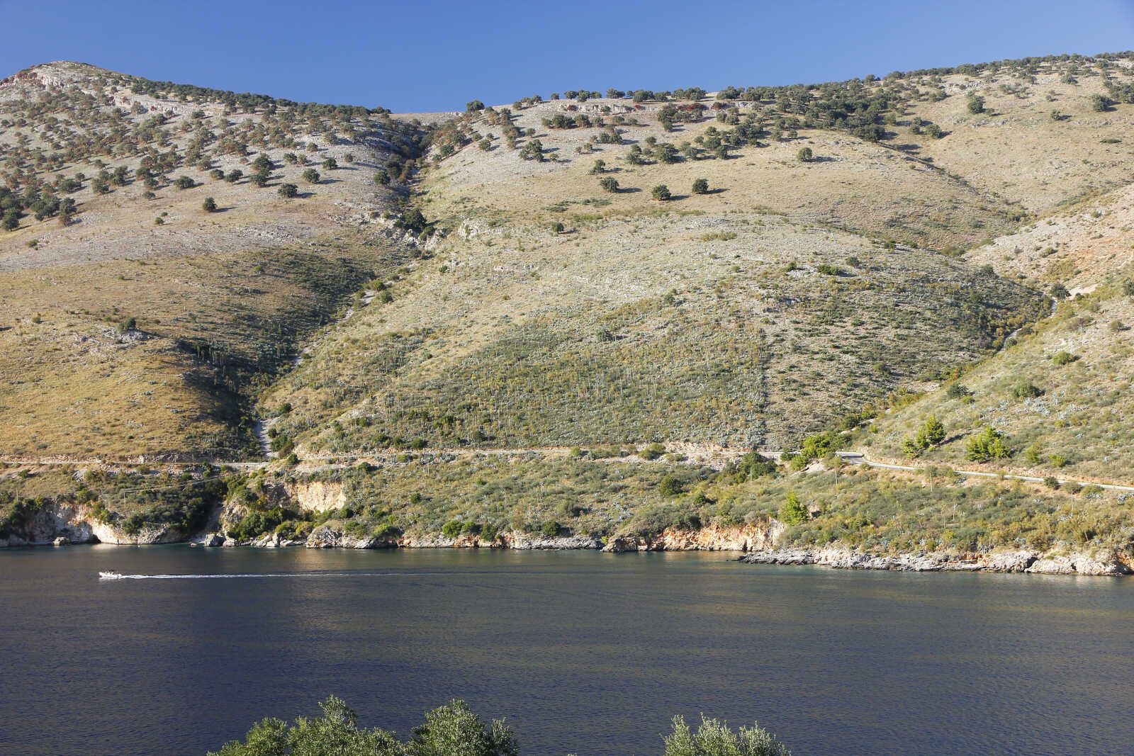
Su questo pendio si vedono le agavi che sono state introdotte negli anni Settanta.
Dal pozzetto di Lilith conosciamo un ragazzo locale che spiaccica solo qualche parola di inglese ma ci tiene a farci sentire benvenuti e sapere qualcosa di noi. Alla fine ci regala qualcosa di sua produzione. Che incontri inaspettati!
Noi la notte la passiamo bene e di venti catabatici nemmeno l'ombra, come aveva previsto il pescatore a cui avevamo chiesto.
Durres, Vlore and Porto Palermo
25 Jan, 2026
On Tuesday 16 September we left Durres. At 0720 we unmoored from the dock in Christian Marina.
We both fell in love with this city and enjoyed our evening outings to find some spots to skate, enjoy Albanian and non-Albanian street food, have a few beers and explore new areas.
In memory of this nice stay, we are left with the less nice stains on the hull caused by the fuel spilled into the water of the port basin that stained the gelcoat near the waterline. We will remedy this cosmetic inconvenience in the next boat yard time that we have already been starting to plan for a while: the idea of going to Gallipoli in Puglia once we have finished sailing along the Albanian coast has been outlined.
Our goal for this transfer was to reach Vlöre which is about 60 miles away.
The wind was there and after a while it also had the right direction for a comfortable navigation.
Like every sail, we had all the time we needed to explore with our eyes and binoculars the details of the coast that slowly paraded beside us. On this stretch of coast, as in much of northern Albania, it is not recommended to sail too close to the coast: the seabed can be shallow even very far from the shore, in the vicinity of the capes there are dangerous shoals that extend for several miles out. It doesn't help that the available mapping is not very accurate/up to date. In addition, the countless pots and fishing nets are poorly marked, so it is advisable to navigate in good conditions of visibility. Until a few years ago there was also the serious danger of anti-ship mines, the residue of the Hoxa regime's paranoid defensive system.
In these quiet conditions we felt like dropping the fishing line. And this time we got lucky: we caught a dolphinfish (also called mahi-mahi) of the perfect size for two. After cleaning it, we put it in the fridge to cook it in the evening.
All this just before the typical afternoon reinforcement of the prevailing NW wind that we galloped with good averages covering many miles.
In the late afternoon the wind began to drop as we werw in sight of the island of Sazan that marks the entrance to the Bay of Vlöre. We decided to open the spinnaker to increase our speed.
Unfortunately, in the preparations to mount the pole and the various sheets for the spi, Mela lost her balance, felt on the rudder tiller and broke it. Luckily she didn't hurt herself, just a couple of bruises and bruised ego. It was not too serious and we realized quickly that we had everything under control: the rudder could still be maneuvered with what remained of the bar, but we decided to lower the sails and switch on the engine to reduce the stress on the rudder so as not to break the fragile pieces of wood left. We had a spare tiller, but I preferred not to replace it at sea. We decided to look for an emergency anchorage and spend the night there, which fortunately was expected to be quiet, at anchor.
We tried with little success to hide from the swell of the open sea behind the extension of the mouth of the Vojussa River.
We anchored in about 5 m of water: the beach was still very far away. I got to work right away to replace the rudder bar. I finished that the sun had set: the days were shortening by the minute.
We consoled ourselves with a nice fish dinner and went to bed early.
The next morning we left at 0730 to cover the 15 miles that separated us from our destination, as soon as the fog, another clue that the end of the summer was approaching, began to clear.
We arrived in Vlore with 20 knots on the stern but found a good anchorage spot, protected by the pier of the commercial port. We stopped for a couple of days to fill our water tanks and buy groceries and see parts of the city we hadn't seen the week before. I even found a small skate park: the only one I've seen all summer. I took advantage of it for some tricks that attract the attention of some kids who stopped to have a chat.
On the 19th we decided to go to visit the island of Sazan which is about 9 miles away: the only port is the military port located in the only bay on the island, where, with permission, one can dock during the day. We were the only sailboat and all the guys of the boats bringing the tourists back and forth from Vlore, wanted to help us with the mooring and were curious to get to know us.
On the island, the largest in Albania, there is a beautiful hike to the top of 337m from which you can enjoy a great view of the Albanian coast, the various capes, river mouths, the lagoon with its salt flats just behind Vlore, the Karaburun peninsula that closes the Bay of Vlora with the Acrocerauni mountain range that dies in the sea and marks a clear change in coastal morphology: from here on begin the high and rocky coasts, the cliffs, the canyons excavated by the torrents that end in the crystal clear sea creating small coves. The Ionian part of Albania begins.
In addition to the colours of the Mediterranean vegetation, the remains of the ghost town that housed the military and their families during the Cold War can still be seen scattered throughout the island. At its peak, 10,000 people lived there, there was even a cinema and a school. Then, with the fall of the communist regime, the settlement soon fell into ruin, being completely dependent on supplies, even for water.
There are also traces of the previous Italian military settlement of the Fascist era, when this island was Italian territory.
Looking to the North you can see the characteristic low and sandy shores and the mouth of the river Vojussa sticking out.
View of the Vlöre lagoon with its salt pans, separated from the open sea by a thin stripe of land.
At the end of the excursion, we returned to Vlore under spinnaker and to the same anchorage for the night.
On the 21st we left to anchor in a beautiful bay on the north side of the tip of the Karaburun peninsula. The entire peninsula is part of a newly established national park. The idea was to spend the day there and then be ready to leave the Bay of Vlora the next day and start sailing south. We tried to wait for the favourable conditions to be able to anchor in one of the small coves characteristic of this coast, but a weather system with wind from the south was coming to stay for several days and we could not wait any longer to be sure of reaching a protected anchorage further south.
So we resigned ourselves to seeing this stretch of coast only while sailing. But what a spectacle it was! The photos don't do justice to the beauty that we had been able to admire for hours. Here the water is deep and we could sail close to the coast and absorb the details of its morphology.
Working in progress for another tourist resort in Dhermi, right after the National Park
After 30 miles we reached our destination: we stopped in Giri Gjipes for the night, anchored in front of the outlet to the sea of avery deep canyon. The anchorage was discreetly protected and we had a quiet night. The next day we went for a walk along the edge of the canyon. What views and colors...
We also stocked up on the thyme and sage that grows abundantly everywhere.
From the left you can see Corfù, Othonoi and Erikousa;the most northern Greek islands.
Once back on board after the walk, we decided to lift the anchor and set sail as the anchorage had become very uncomfortable due to the waves and we decided to head towards Porto Palermo, which is only 7 miles away.
The old town of Himare over the new seaside resort town
We were a little reluctant to go to Porto Palermo because, despite being the only natural port (used since antiquity), according to the accounts we have read, it is difficult to find a good hold and is scourged by very powerful nocturnal katabatic winds. Also the German couple we met in Durres had scared us with the account of their night with winds at 50 knots and dragging anchor.
We decided to at least enter the bay to get our own impression. There should also be a pier used by fishermen but we read that it is always busy and some cruisers have been kicked out badly.
Against all expectations, however, we found the pier completely free and even better: the locals assured us that there was room for us and that we could stay for the night.
We were the only foreign boat in the harbour.
Finally we could savor the bare but mesmerizing landscape of the mountain range that embraces the bay of Palermos. The vast bay is divided in two by an island connected to the land by an isthmus, on which stands the triangular-based fortification with a bastion for each corner. Attributed to Ali Pasha of Ioannina, we visited its dark interior with the high vaults that intersect in complicated geometric subdivisions. Until you emerge into the bright rooftop courtyard that offers a 360-degree view.
Ali was a charismatic figure who grew up in the ranks of the Ottoman bureaucracy and then lead a rebellion that brought much of Albania and northern Greece under his control until his capture and execution in 1822 at the age of 82!
On this slope you can see the agaves coultivations that were introduced in the '70s.
From Lilith's cockpit we met a local guy who spoke very little English but wanted to make us feel welcome and to get to know us a bit. In the end, he even gave us something to smoke of his own production. What unexpected encounters!
We had a good night and not a whistle of the katabatic winds we feared, as the fisherman we had asked had predicted.